
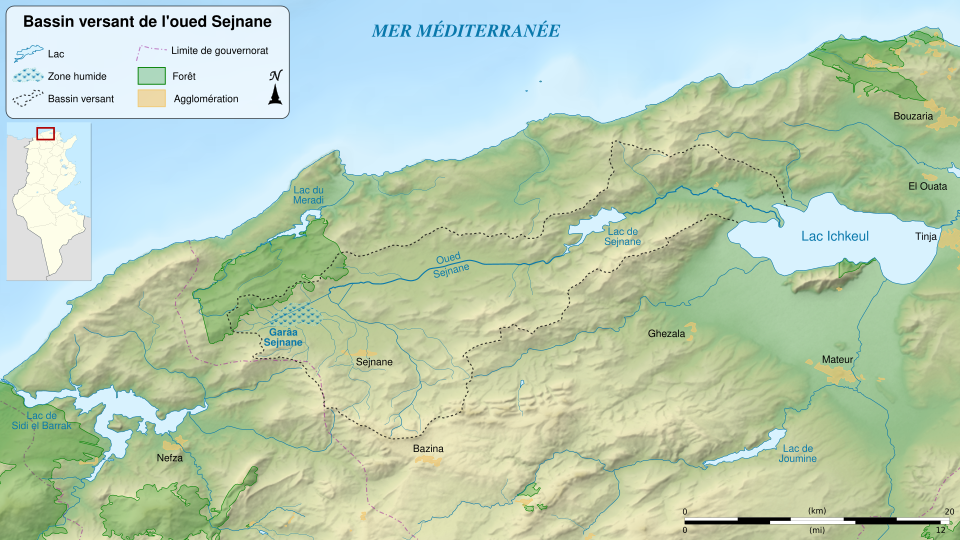
Fayl:Wadi Sejenane drainage basin-fr.svg

Size of this PNG preview of this SVG file: 800 × 450 piksel. Boshqa oʻlchamlari: 2 560 × 1 440 piksel.
Asl fayl (SVG fayl, asl oʻlchamlari 1 712 × 963 piksel, fayl hajmi: 4,63 MB)
Qisqa izoh
| Taʼrif | |||
| Sanasi | (UTC) | ||
| Manba |
English: Sources:
Français : Sources :
|
||
| Muallif | |||
| Other versions | |||
| Attributsiya (required by the license) | © Sémhur / Wikimedia Commons / | ||
| SVG genesis |
|
||
| Graphic Lab |


| Object location |   | View this and other nearby images on: OpenStreetMap |  |
|---|
Litsenziyalash
I, the copyright holder of this work, hereby publish it under the following licenses:
Copyleft: This work of art is free; you can redistribute it and/or modify it according to terms of the Free Art License. You will find a specimen of this license on the Copyleft Attitude site as well as on other sites.
|



This file is licensed under the Creative Commons Attribution-Share Alike 4.0 International, 3.0 Unported, 2.5 Generic, 2.0 Generic and 1.0 Generic license.
- Siz erkinsiz:
- ulashishga – ishlanmani nusxalash, tarqatish va uzatish
- remiks qilishga – ishni moslashtirishga
- Quyidagi shartlar asosida:
- atribut – Siz tegishli litsenziyaga havolani taqdim etishingiz va oʻzgartirishlar kiritilganligini koʻrsatishingiz kerak. Siz buni har qanday oqilona yoʻl bilan qilishingiz mumkin, lekin litsenziar Sizni yoki Sizning foydalanishingizni ma'qullashini taklif qiladigan tarzda emas.
- bir xil ulashish – Agar Siz materialni remiks qilsangiz, oʻzgartirsangiz yoki unga asoslansangiz, oʻz hissalaringizni asl nusxadagi kabi bir xil yoki mos litsenziya ostida tarqatishingiz kerak.
Siz oʻzingiz xohlagan litsenziyani tanlashingiz mumkin.
Fayl tarixi
Faylning biror paytdagi holatini koʻrish uchun tegishli sana/vaqtga bosingiz.
| Sana/Vaqt | Miniatura | Oʻlchamlari | Foydalanuvchi | Izoh | |
|---|---|---|---|---|---|
| joriy | 00:53, 2014-yil 20-aprel | | 1 712 × 963 (4,63 MB) | wikimediacommons>Sémhur | + Carte de localisation |
Fayllarga ishoratlar
Bu faylga quyidagi sahifa bogʻlangan:
