
Fayl:SO1.jpg

Bu prevyuning hajmi: 800 × 593 piksel. Boshqa oʻlchamlari: 1 085 × 804 piksel.
Asl fayl (1 085 × 804 piksel, fayl hajmi: 177 KB, MIME tipi: image/jpeg)

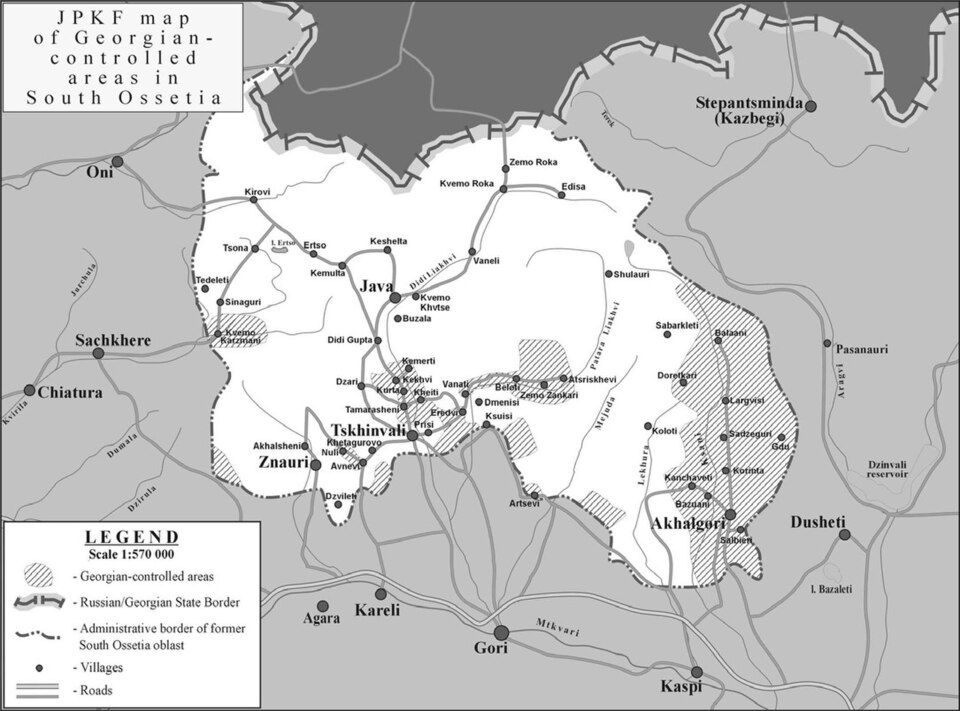
| Taʼrif | South Ossetia detailed map (zones of control according to the joint peacekeeping forces) |
| Sanasi | |
| Manba | International Crisis Group: [1] |
| Muallif | |
| Ruxsat (Bu faylning takror foydalanilishi) |
PD ("Unless otherwise specifically stated, no claim to copyright is being asserted by Crisis Group and material on this website may be freely used as in the public domain.") |
| Other versions | en:Image:SouthOssetia region detailed map.JPG |


|
This work has been released into the public domain by its author, International Crisis Group. This applies worldwide. In some countries this may not be legally possible; if so: International Crisis Group grants anyone the right to use this work for any purpose, without any conditions, unless such conditions are required by law.
|
Fayl tarixi
Faylning biror paytdagi holatini koʻrish uchun tegishli sana/vaqtga bosingiz.
| Sana/Vaqt | Miniatura | Oʻlchamlari | Foydalanuvchi | Izoh | |
|---|---|---|---|---|---|
| joriy | 14:24, 2007-yil 10-iyul | | 1 085 × 804 (177 KB) | wikimediacommons>Alaexis | {{Information |Description=South Ossetia detailed map |Source=International Crisis Group: [http://www.crisisgroup.org/home/index.cfm?id=4887&l=3] |Date=june 2007 |Permission= PD ([http://www.crisisgroup.org/home/index.cfm?l=1&id=1193 "Unless otherwise |
Fayllarga ishoratlar
Bu faylga quyidagi sahifa bogʻlangan:
