
Fayl:NASA FIRMS 2025-08-08 Sredny.png

Bu prevyuning hajmi: 800 × 163 piksel. Boshqa oʻlchamlari: 1 879 × 383 piksel.
Asl fayl (1 879 × 383 piksel, fayl hajmi: 499 KB, MIME tipi: image/png)

Qisqa izoh
| Taʼrif |
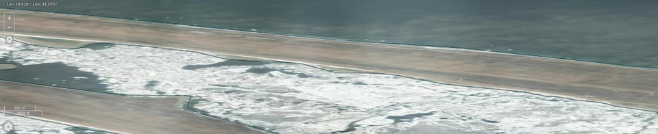
English: NASA FIRMS imagery 2025-08-08 of Sredny airfield. NB. The terrain imagery is older and undated |
| Sanasi | |
| Manba | https://firms.modaps.eosdis.nasa.gov/map/#d:2025-08-08;@91.08,79.52,14.00z |
| Muallif | Imagery from LANCE FIRMS operated by NASA's Earth Science Data and Information System (ESDIS) with funding provided by NASA Headquarters. |
| Camera location |  | View this and other nearby images on: OpenStreetMap |  |
|---|

Litsenziyalash

|
This file is in the public domain in the United States because it was solely created by NASA. NASA copyright policy states that "NASA material is not protected by copyright unless noted". (See Template:PD-USGov, NASA copyright policy page or JPL Image Use Policy.) |  |
 |
Warnings:
|

Fayl tarixi
Faylning biror paytdagi holatini koʻrish uchun tegishli sana/vaqtga bosingiz.
| Sana/Vaqt | Miniatura | Oʻlchamlari | Foydalanuvchi | Izoh | |
|---|---|---|---|---|---|
| joriy | 15:44, 2025-yil 15-avgust | | 1 879 × 383 (499 KB) | wikimediacommons>Lklundin | Improve cropping |
Fayllarga ishoratlar
Bu faylga quyidagi sahifa bogʻlangan:
