
Fayl:Momhil trivor ISS.png

Bu prevyuning hajmi: 488 × 599 piksel. Boshqa oʻlchamlari: 1 306 × 1 603 piksel.
Asl fayl (1 306 × 1 603 piksel, fayl hajmi: 3,79 MB, MIME tipi: image/png)

| Taʼrif |
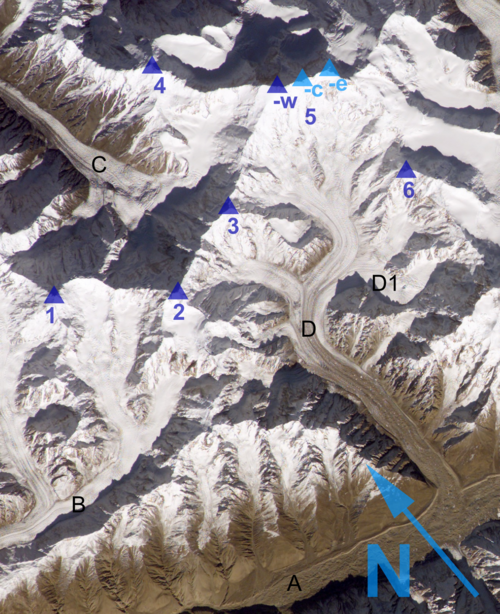
English: Western part of the Hispar Muztagh (cropped from this pichture) Deutsch: Westteil des Hispar Muztagh (Ausschnitt von diesem Bild) |
| Sanasi | (UTC) |
| Manba | |
| Muallif |
|

|
|
|
1: Momhil Sar (7343 m) |
A: Hispar Glacier |
 |
This is a retouched picture, which means that it has been digitally altered from its original version. Modifications: western part. The original can be viewed here: Hispar Muztagh labels.png:  .
|

|
This file is in the public domain in the United States because it was solely created by NASA. NASA copyright policy states that "NASA material is not protected by copyright unless noted". (See Template:PD-USGov, NASA copyright policy page or JPL Image Use Policy.) |  |
 |
Warnings:
|

Original upload log
This image is a derivative work of the following images:
- File:Hispar_Muztagh_labels.png licensed with PD-USGov-NASA
- 2010-03-03T14:26:02Z Rupert Pupkin 1012x668 (1899789 Bytes) {{Information |Description={{en|1=Hispar glacier and Hispar Muztagh above with Distaghil Sar, Kunyang Chhish, Pumari Chhish (An adjacent picture to the east is ''[[:File:ESC large ISS014 ISS014-E-6852.JPG|here]]'')}} {{de|1=D
Uploaded with derivativeFX
Fayl tarixi
Faylning biror paytdagi holatini koʻrish uchun tegishli sana/vaqtga bosingiz.
| Sana/Vaqt | Miniatura | Oʻlchamlari | Foydalanuvchi | Izoh | |
|---|---|---|---|---|---|
| joriy | 05:38, 2010-yil 4-mart | | 1 306 × 1 603 (3,79 MB) | wikimediacommons>Rupert Pupkin | neu erstellt mit bild in originalgröße |
Fayllarga ishoratlar
Bu faylga quyidagi sahifa bogʻlangan:
