
Fayl:Map Strasbourg.jpg

Bu prevyuning hajmi: 386 × 599 piksel. Boshqa oʻlchamlari: 1 589 × 2 464 piksel.
Asl fayl (1 589 × 2 464 piksel, fayl hajmi: 3,9 MB, MIME tipi: image/jpeg)

|
This city map image could be re-created using vector graphics as a SVG file. This has several advantages; see Commons:Media for cleanup for more information. If a SVG form of this image is available, please upload it and afterwards replace this template with
{{vector version available|new image name}}.It is recommended to name the SVG file “Map Strasbourg.svg”—then the template Vector version available (or Vva) does not need the new image name parameter. |



Qisqa izoh
| Taʼrif |
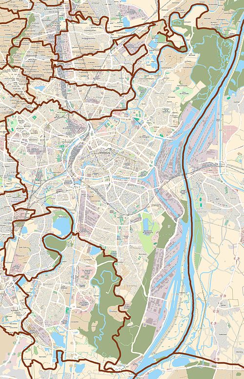
English: Map of Strasbourg, France.
Français : Carte de Strasbourg, France.
Deutsch: Karte von Straßburg, Frankreich. |
||||||||||||
| Sanasi | |||||||||||||
| Manba |
|
||||||||||||
| Muallif | OpenStreetMap contributors |
Litsenziyalash


Bu fayl Creative Commons asosida litsenziyalangan Attribution- Share Alike 3.0 Unported litsenziyasi.
- Siz erkinsiz:
- ulashishga – ishlanmani nusxalash, tarqatish va uzatish
- remiks qilishga – ishni moslashtirishga
- Quyidagi shartlar asosida:
- atribut – Siz tegishli litsenziyaga havolani taqdim etishingiz va oʻzgartirishlar kiritilganligini koʻrsatishingiz kerak. Siz buni har qanday oqilona yoʻl bilan qilishingiz mumkin, lekin litsenziar Sizni yoki Sizning foydalanishingizni ma'qullashini taklif qiladigan tarzda emas.
- bir xil ulashish – Agar Siz materialni remiks qilsangiz, oʻzgartirsangiz yoki unga asoslansangiz, oʻz hissalaringizni asl nusxadagi kabi bir xil yoki mos litsenziya ostida tarqatishingiz kerak.
Fayl tarixi
Faylning biror paytdagi holatini koʻrish uchun tegishli sana/vaqtga bosingiz.
| Sana/Vaqt | Miniatura | Oʻlchamlari | Foydalanuvchi | Izoh | |
|---|---|---|---|---|---|
| joriy | 01:45, 2011-yil 23-oktyabr | | 1 589 × 2 464 (3,9 MB) | wikimediacommons>XIIIfromTOKYO | better colors |
Fayllarga ishoratlar
Bu faylga quyidagi 2 sahifalar bogʻlangan:
