
Fayl:M 7.8 - Central Turkey.jpg

Bu prevyuning hajmi: 448 × 599 piksel. Boshqa oʻlchamlari: 749 × 1 001 piksel.
Asl fayl (749 × 1 001 piksel, fayl hajmi: 181 KB, MIME tipi: image/jpeg)

Qisqa izoh
| Taʼrif |
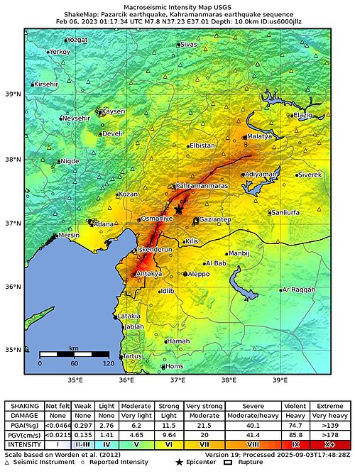
English: Shakemap of a magnitude 7.8 earthquake in Turkey |
| Sanasi | |
| Manba | [1] |
| Muallif | United States Geological Survey |
Litsenziyalash

|
This image is in the public domain in the United States because it only contains materials that originally came from the United States Geological Survey, an agency of the United States Department of the Interior. For more information, see the official USGS copyright policy.
|
 |
Fayl tarixi
Faylning biror paytdagi holatini koʻrish uchun tegishli sana/vaqtga bosingiz.
| Sana/Vaqt | Miniatura | Oʻlchamlari | Foydalanuvchi | Izoh | |
|---|---|---|---|---|---|
| joriy | 18:18, 2026-yil 3-may | | 749 × 1 001 (181 KB) | wikimediacommons>Dora the Axe-plorer | updated map |
Fayllarga ishoratlar
Bu faylga quyidagi sahifa bogʻlangan:
