
Fayl:Jerusalem-A-Quds-2013(2)-Aerial-Al-Aqsa Mosque Compound-(south exposure).jpg

Bu prevyuning hajmi: 800 × 495 piksel. Boshqa oʻlchamlari: 2 560 × 1 585 piksel | 6 426 × 3 979 piksel.
Asl fayl (6 426 × 3 979 piksel, fayl hajmi: 27,17 MB, MIME tipi: image/jpeg)
Qisqa izoh
| Taʼrif |
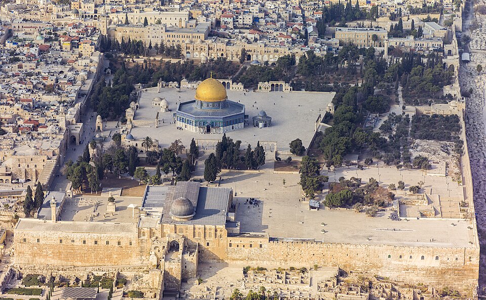
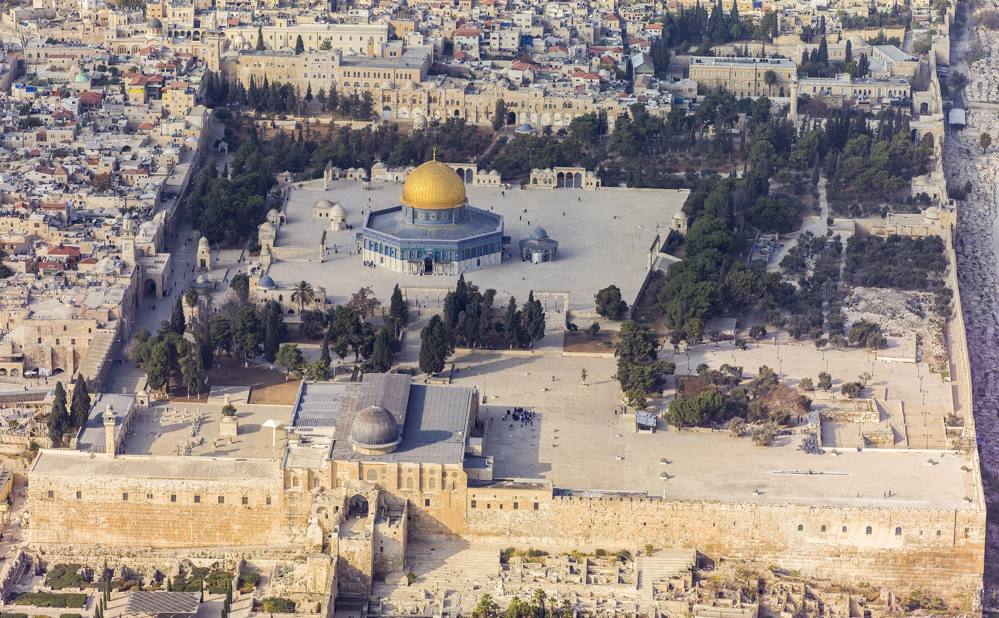
العربية: لقطة جويَّة جنوبيَّة للحرم القدسي الشريف، الواقع في بلدة القدس القديمة. يظهرُ في المُقدِّمة المسجد القبلي الذي يُخطئ الكثير من النَّاس ويعتقدون أنَّه المسجد الأقصى، ثالثُ أقدس الأماكن في الإسلام بعد المسجد الحرام والمسجد النبوي، في حين أنَّ هذا المُجمَّع بأكمله هو المسجد الأقصى. تظهرُ في الخلف قبَّة الصخرة وإلى يمينها قبَّة السلسلة، التي شُيِّدت خلال العهد الأُمويّ (حوالي سنة 685 للميلاد) واتُخذت نموذجًا لبناء قبَّة الصخرة (حوالي سنة. 691 للميلاد). يعتبرُ اليهود أنَّ هيكل سُليمان، وهو أقدسُ الأماكن في اليهوديَّة يقعُ أسفل المسجد الأقصى.
English: Southern aerial view of the Temple Mount (Hebrew: הַר הַבַּיִת, Har HaBáyit, Arabic: الحرم الشريف, al-Ḥaram al-Šarīf), showing, Al-Aqsa Mosque (Hebrew: הַר הַבַּיִת, Arabic: المسجد الأقصى المبارك) in the Old City of Jerusalem (Hebrew: העיר העתיקה, Arabic: البلدة القديمة). Annotated in the foreground is Al-Aqsa Mosque (Arabic: ٱلْمَسْجِد ٱلْأَقْصَى). Al-Aqsa Mosque is considered to be the third holiest site in Islam after Mecca and Medina. Behind are The Dome of the Rock (Hebrew: כיפת הסלע, Arabic: مسجد قبة الصخرة) and to the right, The Dome of the Chain (Arabic: قبة السلسلة, Qubbat al-Silsila), constructed during the Umayyad Caliphate (c. 685 AD) and served as a model for the building of the Dome of the Rock (c. 691 AD). The Temple Mount, which is called by Muslims Al-Aqsa Mosque, is considered to be the premier holy site in Judaism as it is the place where the first and second Temples stood.
עברית: מבט מדרום על הר הבית בעיר העתיקה בירושלים. בחזית רואים את מסגד אל-אקצה, שנחשב לשלישי בדרגת הקדושה באיסלם, אחרי מכה ומדינה. מאחור כיפת הסלע ומימין כיפת השלשלת, שנבנתה בתקופת חליפות אומיה ושימשה כמודל לבניית כיפת הסלע. הר הבית, עליו נבנה מסגד אל-אקצה נחשב למקום הקדוש ביותר ביהדות, כיוון שעליו נצבו בית המקדש הראשון והשני.
Türkçe: Tapınak Dağı'nın (İbranice: הַר הַבַּיִת, Har HaBáyit, Arapça: الحرم الشريف, al-Ḥaram al-Šarīf) güneyden havadan görünümü, Mescid-i Aksa'yı (İbranice: הַר הַבַּיִת, Arapça: المسجد الأقصى المبارك), Kudüs'ün Eski Şehri'nde (İbranice: העיר העתיקה, Arapça: البلدة القديمة). Ön planda El-Aksa Camii (Arapça: ٱلْمَسْجِد ٱلْأَقْصَى) gösterilmektedir. Mescid-i Aksa, Mekke ve Medine'den sonra İslam'ın en kutsal üçüncü mekânı olarak kabul edilir. Arkada Kubbet-üs Sahra (İbranice: כיפת הסלע, Arapça: مسجد قبة الصخرة) ve sağda Kubbet-üs Sahra (Arapça: قبة السلسلة, Qubbat al-Silsila), Emevi Halifeliği döneminde (yaklaşık MS 685) ve Kubbetü's-Sahra'nın (MS 691) inşası için bir model olarak hizmet etmiştir. Müslümanlar tarafından Mescid-i Aksa olarak adlandırılan Tapınak Dağı, birinci ve ikinci Tapınakların bulunduğu yer olması nedeniyle Yahudilikte en önemli kutsal alan olarak kabul edilmektedir. |
| Sanasi | |
| Manba | Oʻzimning ishim |
| Muallif | Godot13 |
| Other versions | |
| Attributsiya (required by the license) | Andrew Shiva / Wikipedia / |



| Camera location |   | View this and other nearby images on: OpenStreetMap |  |
|---|

Assessment
Litsenziyalash
I, the copyright holder of this work, hereby publish it under the following license:


This file is licensed under the Creative Commons Attribution-Share Alike 4.0 International license.
- Siz erkinsiz:
- ulashishga – ishlanmani nusxalash, tarqatish va uzatish
- remiks qilishga – ishni moslashtirishga
- Quyidagi shartlar asosida:
- atribut – Siz tegishli litsenziyaga havolani taqdim etishingiz va oʻzgartirishlar kiritilganligini koʻrsatishingiz kerak. Siz buni har qanday oqilona yoʻl bilan qilishingiz mumkin, lekin litsenziar Sizni yoki Sizning foydalanishingizni ma'qullashini taklif qiladigan tarzda emas.
- bir xil ulashish – Agar Siz materialni remiks qilsangiz, oʻzgartirsangiz yoki unga asoslansangiz, oʻz hissalaringizni asl nusxadagi kabi bir xil yoki mos litsenziya ostida tarqatishingiz kerak.

|
The copyright holder of this file, Andrew Shiva, allows anyone to use it for any purpose, provided that the copyright holder is properly attributed. Redistribution, derivative work, commercial use, and all other use is permitted. |
Attributsiya:
Use or reproduction of this image outside of Wikipedia must give the original photographer (Andrew Shiva) credit. Although not required, it would be appreciated if a message was left here indicating where this image was being used.
|
| Annotations | This image is annotated: View the annotations at Commons |
Fayl tarixi
Faylning biror paytdagi holatini koʻrish uchun tegishli sana/vaqtga bosingiz.
| Sana/Vaqt | Miniatura | Oʻlchamlari | Foydalanuvchi | Izoh | |
|---|---|---|---|---|---|
| joriy | 01:45, 2026-yil 22-iyun | | 6 426 × 3 979 (27,17 MB) | wikimediacommons>Prosnu | File:Jerusalem-2013(2)-Aerial-Temple Mount-(south exposure).jpg cropped 14% horizontally, 29% vertically, 39% areawise using CropTool2 with precise mode. |

Fayllarga ishoratlar
Bu faylga quyidagi sahifa bogʻlangan:
