
Fayl:IslandsofBombay1893.jpg

Bu prevyuning hajmi: 390 × 599 piksel. Boshqa oʻlchamlari: 521 × 800 piksel.
Asl fayl (521 × 800 piksel, fayl hajmi: 102 KB, MIME tipi: image/jpeg)

Qisqa izoh
| Taʼrif |
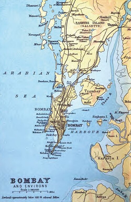
English: This is an 1893 map of the original islands of Bombay before they were merged to form the present-day geographic entity. |
||||
| Sanasi | |||||
| Manba | Constable's Hand Atlas of India, 1893 edition | ||||
| Muallif | J.G. Bartholomew, Archibald Constable and Company | ||||
| Ruxsat (Bu faylning takror foydalanilishi) |
|
||||
Litsenziyalash
 |
This media file is in the public domain in the United States. This applies to U.S. works where the copyright has expired, often because its first publication occurred prior to January 1, 1931, and if not then due to lack of notice or renewal. See this page for further explanation.
|
 |
 |
Fayl tarixi
Faylning biror paytdagi holatini koʻrish uchun tegishli sana/vaqtga bosingiz.
| Sana/Vaqt | Miniatura | Oʻlchamlari | Foydalanuvchi | Izoh | |
|---|---|---|---|---|---|
| joriy | 07:46, 2009-yil 19-iyun | | 521 × 800 (102 KB) | wikimediacommons>Hunnjazal | {{Information |Description={{en|1=This is an 1893 map of the original islands of Bombay before they were merged to form the present-day geographic entity.}} |Source=Constable's Hand Atlas of India, 1893 edition |Author=J.G. Bartholomew, Archibald Constabl |
Fayllarga ishoratlar
Bu faylga quyidagi sahifa bogʻlangan:
