
Fayl:India population density map en.svg

Qisqa izoh
| Nomi |
India population density map |
|||||||||
| Description |
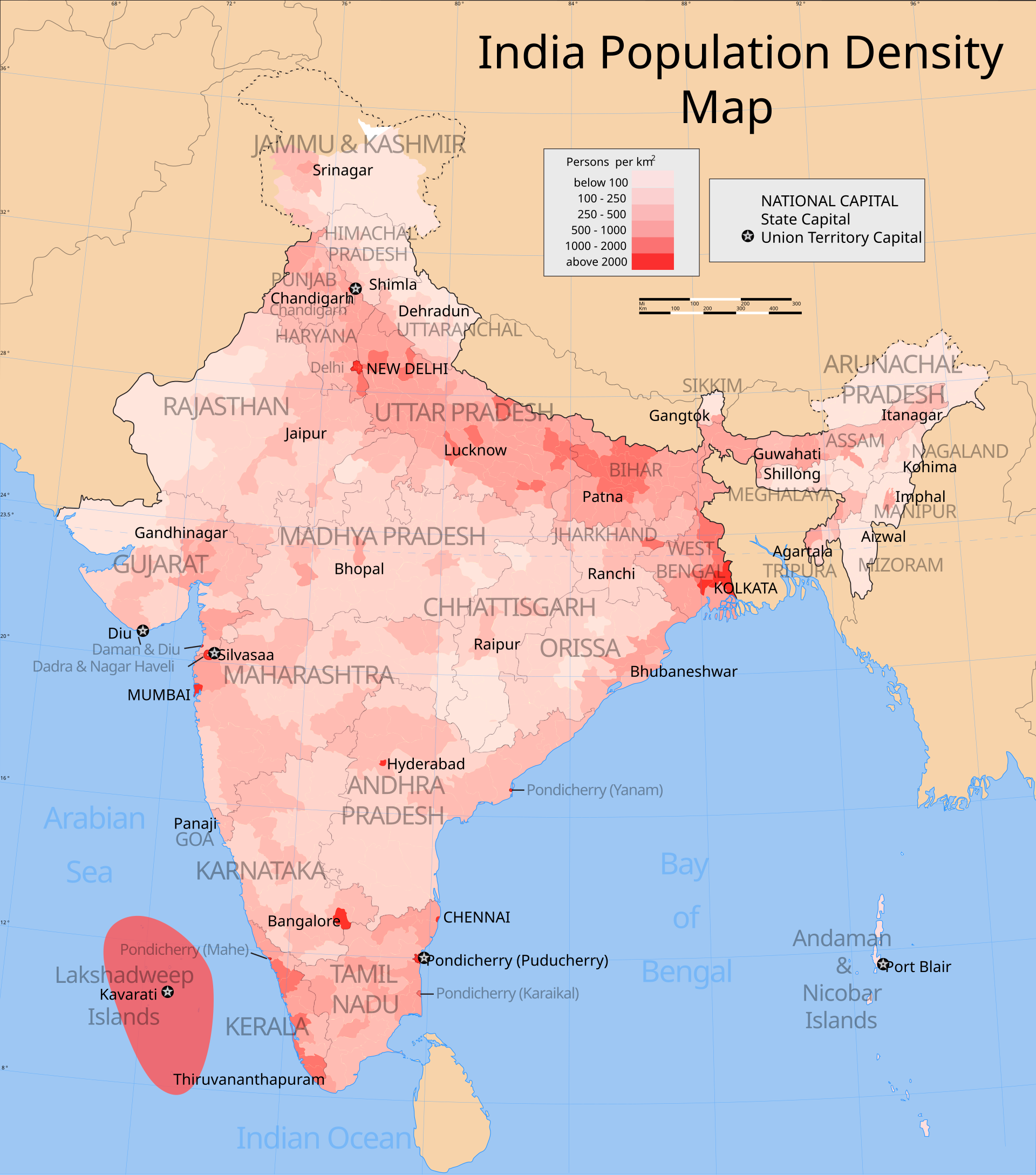
English: Map showing the population density of each district in India. Based on 2001 census. Texts in English. |
|||||||||
| Map legend |
 |
|||||||||
| SVG genesis | ||||||||||
| Sanasi | ||||||||||
| Manba | Oʻzimning ishim | |||||||||
| Yaratuvchi |
|
|||||||||
| Ruxsat (Bu faylning takror foydalanilishi) |
PlaneMad, the copyright holder of this work, hereby publishes it under the following license:    Bu fayl Creative Commons asosida litsenziyalangan Attribution- Share Alike 3.0 Unported litsenziyasi. Attributsiya: PlaneMad/Wikimedia
|
|||||||||
| Geotemporal data | ||||||||||
| Date depicted | second half of 20 century va 21 century | |||||||||
| Spatial reference system | conic | |||||||||
| Heading |
 |
|||||||||
| Bounding box |
|
|||||||||
| Georeferencing | If inappropriate please set warp_status = skip to hide. | |||||||||
| Archival data | ||||||||||
| Notes | Part of WikiProject India Maps | |||||||||
| Other versions |
[]
Derivative works of this file: |
|||||||||






Notes
Depiction of India's borders
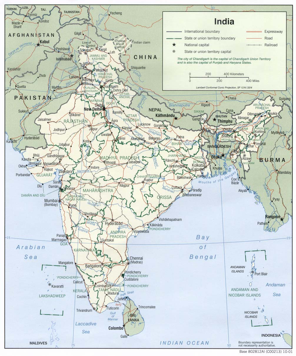
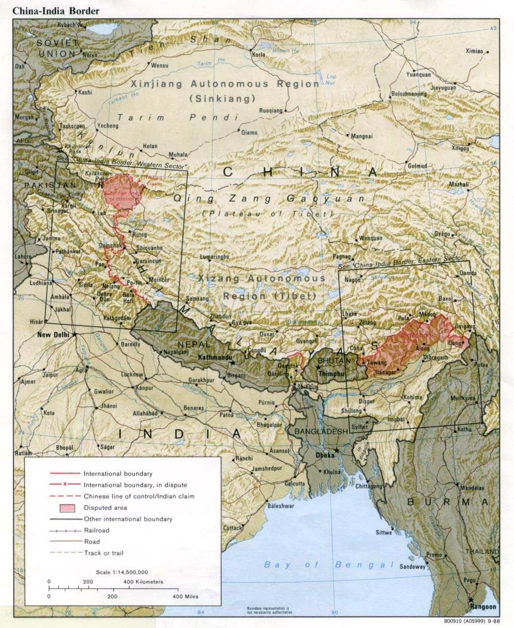
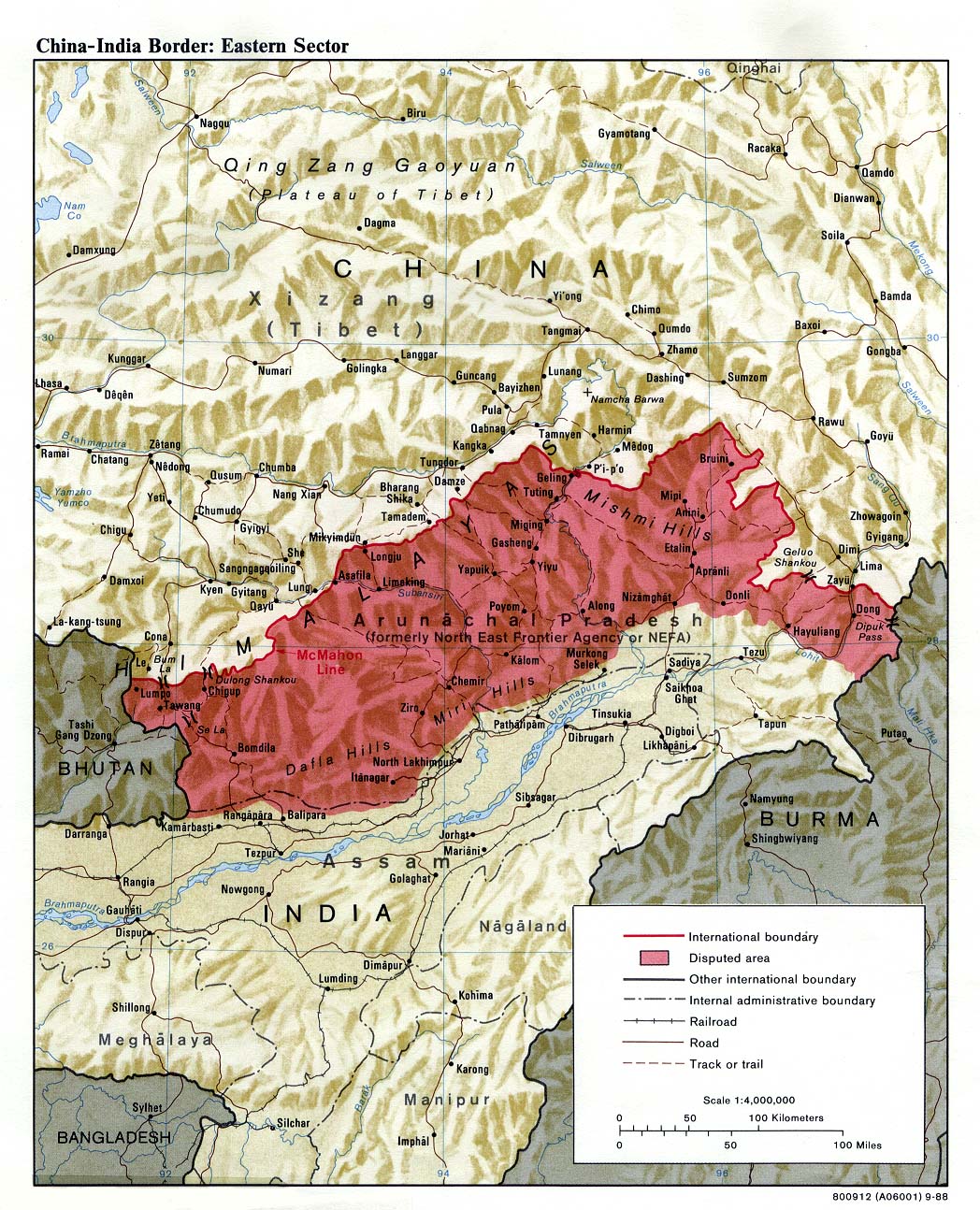
- The territorial boundaries of India are shown as per the actual ground situation in accordance with international practices followed by the United Nations ([1], [2]) and the National Geographic Society ([3], [4])
- This map is meant to be for illustrative purposes only and is not authenticated by official government sources. Please check the list of sources and references used to create the map for a measure of accuracy and verifiability.
- The usage of these maps in India, Pakistan and China is governed by different laws that restrict depictions of boundaries other than what is officially recognized by the state. Please check local laws and modify the map accordingly before use.
Explanation of disputed boundaries


- Boundary of Indian claim : The territory India claims is legally theirs, but the claim is disputed by China and Pakistan.
- Line of Control/Line of Conflict : The de facto administrative boundary recognised by the international community. This UN ceasefire line is considered as a temporary solution to the ongoing conflict since the departure of the British Raj.
Borders of disputed regions
The depicted extent of the former territory of the British Indian Empire, succeeded by Republic of India, may not be accepted by a few countries as legal due to ongoing border disputes:
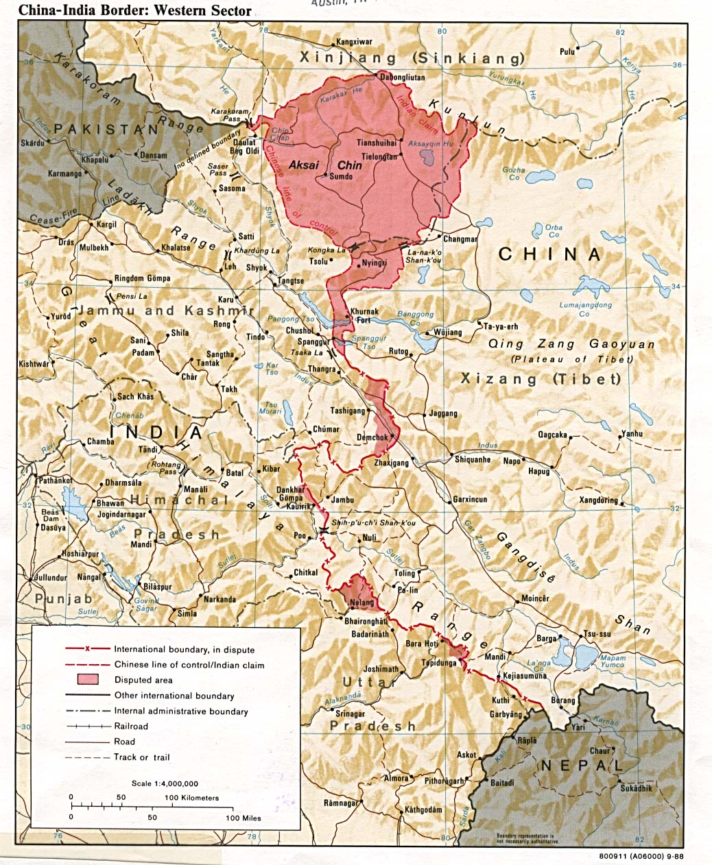
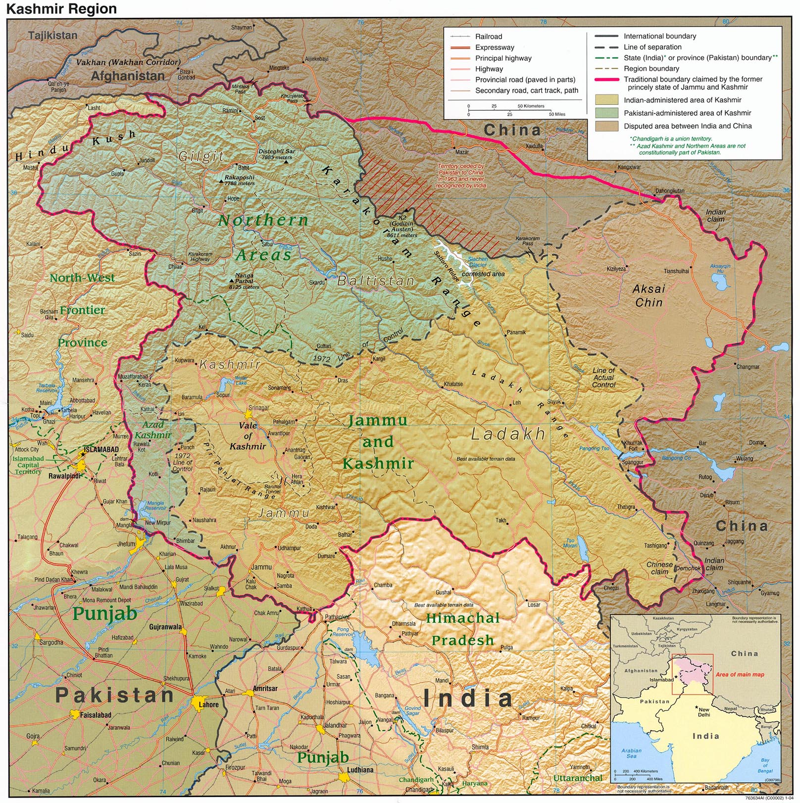
- The northern Himalayan region of the disputed territory Indian-administered Kashmir is claimed by India including Pakistan-administered Kashmir and the Chinese-occupied territory of Ladakh plateau. Since 1972, it is divided between all three countries. See also Line of Control and Line of Actual Control.
- Siachen glacier (shown in white) is an actively contested region between India and Pakistan. Since 1984, the region is under Indian control.
- The northeastern territory of Arunachal Pradesh is almost entirely claimed by China as part of its Tibetan territory.
- Minor areas of eastern Kashmir's Ladakh division, Himachal Pradesh and Uttarakhand on the Chinese frontier are claimed by China. These areas are under Indian control.
- A small area of Uttarakhand adjoining the Nepal border along the Sarda river is disputed between the two countries.
For a detailed map of all disputed regions in South Asia, see Image:India disputed areas map.svg
Internal borders
The borders of the state of Meghalaya, Assam and Arunachal Pradesh are shown as interpreted from the North-Eastern Areas (Reorganisation) Act, 1971, but are yet to be verified.
Territorial waters
The limit of the territorial waters of India extends to twelve nautical miles measured from the appropriate baseline. See this for more information.
Fayl tarixi
Faylning biror paytdagi holatini koʻrish uchun tegishli sana/vaqtga bosingiz.
| Sana/Vaqt | Miniatura | Oʻlchamlari | Foydalanuvchi | Izoh | |
|---|---|---|---|---|---|
| joriy | 02:04, 2026-yil 28-sentyabr | | 1 636 × 1 854 (729 KB) | wikimediacommons>Sebastian Wallroth | SVGOMG // Editing SVG source code using c:User:Rillke/SVGedit.js |
Fayllarga ishoratlar
Bu faylga quyidagi sahifa bogʻlangan:
