
Fayl:Ile de France.svg

Size of this PNG preview of this SVG file: 777 × 581 piksel. Boshqa oʻlchamlari: 2 560 × 1 914 piksel.
Asl fayl (SVG fayl, asl oʻlchamlari 777 × 581 piksel, fayl hajmi: 95 KB)

Qisqa izoh
| Taʼrif |
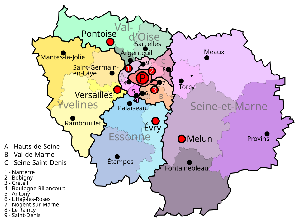
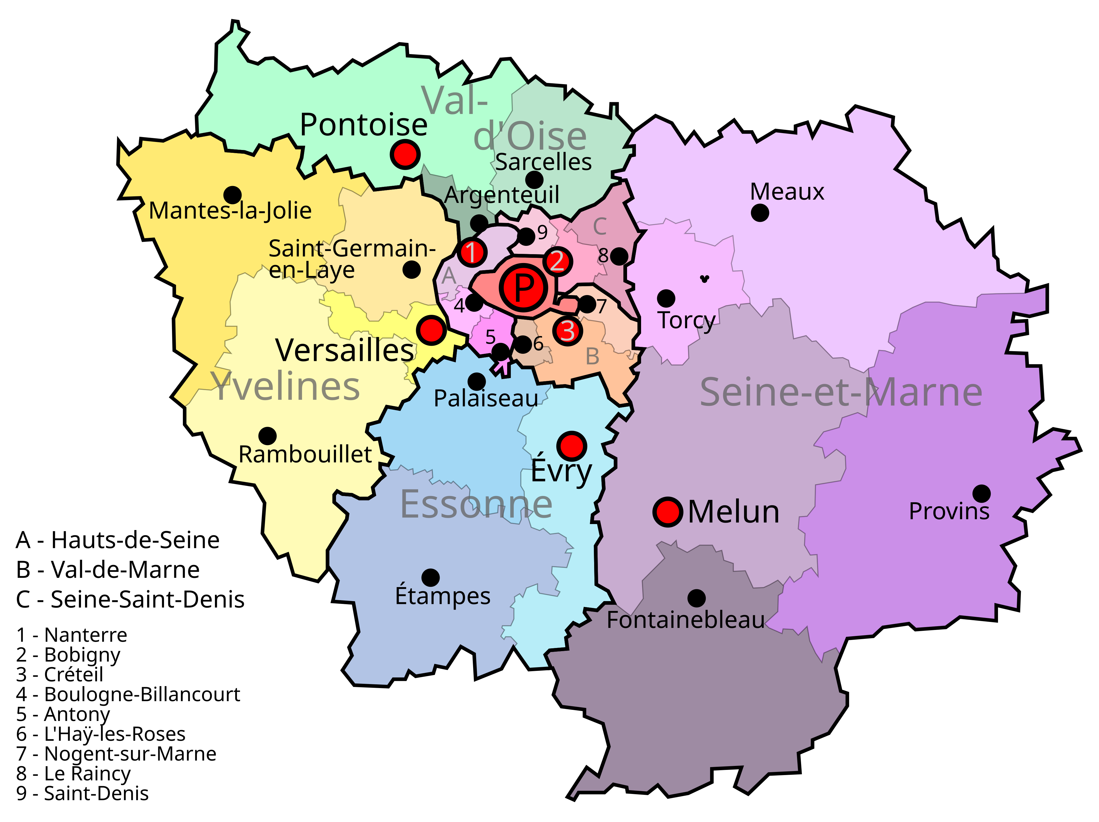
English: Map of the French region of Île de France. The largest color blocks with thick black lines are the eight departments: Large red P for Paris, A, B, C, and all-caps light grey entities (e.g. Val-d'Oise). Smaller color blocks are the arrondissments of the department. Red dots are the communes that are the prefecture (capital of the department and the arrondissment). Black dots are the subprefectures (capitals of the arrondisments, which have the same name). Paris is both a commune and a department, and is also the prefecture (capital) of the region and the capital of the country.
Español: Mapa de Île de France |
| Sanasi | |
| Manba | Oʻzimning ishim |
| Muallif | Jome |
| Camera location |  | View this and other nearby images on: OpenStreetMap |  |
|---|

Litsenziyalash

|
I, the copyright holder of this work, release this work into the public domain. This applies worldwide. In some countries this may not be legally possible; if so: I grant anyone the right to use this work for any purpose, without any conditions, unless such conditions are required by law. |
Fayl tarixi
Faylning biror paytdagi holatini koʻrish uchun tegishli sana/vaqtga bosingiz.
| Sana/Vaqt | Miniatura | Oʻlchamlari | Foydalanuvchi | Izoh | |
|---|---|---|---|---|---|
| joriy | 21:19, 2011-yil 9-iyul | | 777 × 581 (95 KB) | wikimediacommons>AnonMoos | adjust margins |
Fayllarga ishoratlar
Bu faylga quyidagi sahifa bogʻlangan:
