
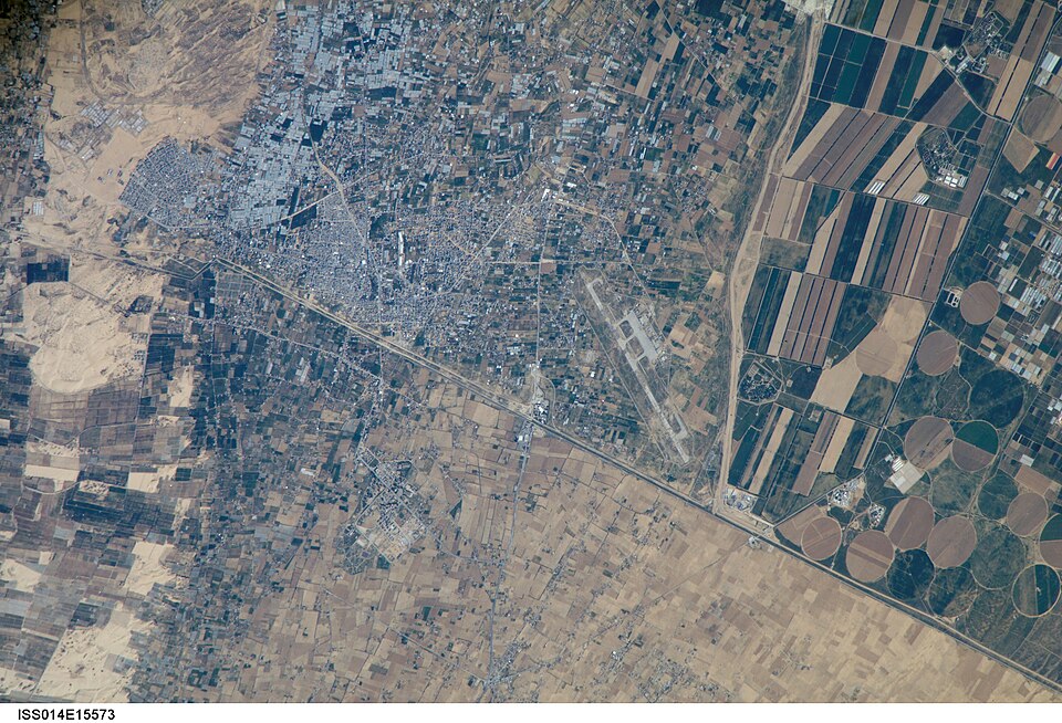
Fayl:ISS014-E-15573 - View of Israel.jpg

Bu prevyuning hajmi: 800 × 545 piksel. Boshqa oʻlchamlari: 2 560 × 1 743 piksel | 3 032 × 2 064 piksel.
Asl fayl (3 032 × 2 064 piksel, fayl hajmi: 1,67 MB, MIME tipi: image/jpeg)
Qisqa izoh
| Taʼrif | |
| Sanasi | |
| Manba | JSC Gateway to Astronaut Photography of Earth |
| Muallif | Earth Science and Remote Sensing Unit, Lyndon B. Johnson Space Center |
| Mission | ISS014 |
| Roll | E |
| Frame | 15573 |
| Geographic area | Israel |
| Features | RAFAH, AGRICULTURE, Gaza Strip border, airport |
| Cloud percentage | 10% |
| Altitude | 184 nautical miles (341 km) |
| Look angle | 31 |
| Look direction | S |
| Sun Azimuth | 174° |
| Sun Elevation | 49° |
| Camera | Kodak DCS760c Electronic Still Camera |
| Focal length | 800 mm |
| Object location |  | View this and other nearby images on: OpenStreetMap |  |
|---|

| Camera location | | View this and other nearby images on: OpenStreetMap | |
|---|



|
This image or video was catalogued by Lyndon B. Johnson Space Center of the United States National Aeronautics and Space Administration (NASA) under Photo ID: ISS014-E-15573. This tag does not indicate the copyright status of the attached work. A normal copyright tag is still required. See Commons:Licensing. Other languages:
|
Litsenziyalash

|
This file is in the public domain in the United States because it was solely created by NASA. NASA copyright policy states that "NASA material is not protected by copyright unless noted". (See Template:PD-USGov, NASA copyright policy page or JPL Image Use Policy.) |  |
 |
Warnings:
|

| Annotations | This image is annotated: View the annotations at Commons |
Fayl tarixi
Faylning biror paytdagi holatini koʻrish uchun tegishli sana/vaqtga bosingiz.
| Sana/Vaqt | Miniatura | Oʻlchamlari | Foydalanuvchi | Izoh | |
|---|---|---|---|---|---|
| joriy | 14:54, 2021-yil 15-oktyabr | Miniatyurasi yoʻq | 3 032 × 2 064 (1,67 MB) | wikimediacommons>Askeuhd |
Fayllarga ishoratlar
Bu faylga quyidagi sahifa bogʻlangan:
