
Fayl:Greece relief location map.jpg

Bu prevyuning hajmi: 729 × 600 piksel. Boshqa oʻlchamlari: 1 003 × 825 piksel.
Asl fayl (1 003 × 825 piksel, fayl hajmi: 691 KB, MIME tipi: image/jpeg)

|
This map image could be re-created using vector graphics as a SVG file. This has several advantages; see Commons:Media for cleanup for more information. If a SVG form of this image is available, please upload it and afterwards replace this template with
{{vector version available|new image name}}.It is recommended to name the SVG file “Greece relief location map.svg”—then the template Vector version available (or Vva) does not need the new image name parameter. |



| Taʼrif |
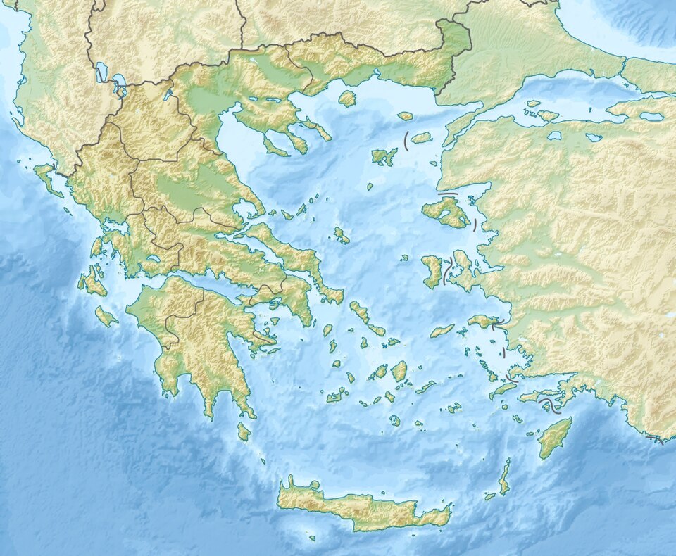
Deutsch: Positionskarte von Griechenland Quadratische Plattkarte, N-S-Streckung 120 %. Geographische Begrenzung der Karte: * N: 42.0° N * S: 34.6° N * W: 19.1° O * O: 29.9° O English: Location map of Greece Equirectangular projection, N/S stretching 120 %. Geographic limits of the map: * N: 42.0° N * S: 34.6° N * W: 19.1° E * O: 29.9° E |
| Sanasi | (UTC) |
| Manba | |
| Muallif |
|
| Other versions |
|
 |
This is a retouched picture, which means that it has been digitally altered from its original version. Modifications: relief map. The original can be viewed here: Greece location map.svg:  . Modifications made by Uwe Dedering. . Modifications made by Uwe Dedering.
|
I, the copyright holder of this work, hereby publish it under the following licenses:


Bu fayl Creative Commons asosida litsenziyalangan Attribution- Share Alike 3.0 Unported litsenziyasi.
- Siz erkinsiz:
- ulashishga – ishlanmani nusxalash, tarqatish va uzatish
- remiks qilishga – ishni moslashtirishga
- Quyidagi shartlar asosida:
- atribut – Siz tegishli litsenziyaga havolani taqdim etishingiz va oʻzgartirishlar kiritilganligini koʻrsatishingiz kerak. Siz buni har qanday oqilona yoʻl bilan qilishingiz mumkin, lekin litsenziar Sizni yoki Sizning foydalanishingizni ma'qullashini taklif qiladigan tarzda emas.
- bir xil ulashish – Agar Siz materialni remiks qilsangiz, oʻzgartirsangiz yoki unga asoslansangiz, oʻz hissalaringizni asl nusxadagi kabi bir xil yoki mos litsenziya ostida tarqatishingiz kerak.

|
Ushbu hujjatdan nusxa ko‘chirish, tarqatish va/yoki o‘zgartirish uchun GNU Erkin guvohnoma litsenziyasi (GNU Free Documentation License), 1.2 va har qanday keyingi versiyalar shartlariga muvofiq ruxsat berilgan yoki Ochiq kodli dasturlar jamiyati (Free Software Foundation) tomonidan chop etilgan; oʻzgarmas boʻlimlarsiz, oldingi muqova matnlari va orqa muqova matnlarisiz. Litsenziya nusxasi GNU Erkin guvohnoma litsenziyasi (GNU Free Documentation License) boʻlimiga kiritilgan. |
Siz oʻzingiz xohlagan litsenziyani tanlashingiz mumkin.
Original upload log
This image is a derivative work of the following images:
- File:Greece_location_map.svg licensed with Cc-by-sa-3.0, GFDL
- 2008-09-11T16:28:02Z Lencer 1003x825 (852751 Bytes) {{Information |Description= |Source= |Date= |Author= |Permission= |other_versions= }}
- 2008-08-16T12:13:31Z Lencer 1003x825 (838049 Bytes) {{Information |Description= |Source= |Date= |Author= |Permission= |other_versions= }}
- 2008-07-23T18:26:04Z Lencer 869x715 (842748 Bytes) {{Information |Description= |Source= |Date= |Author= |Permission= |other_versions= }}
- 2008-07-23T18:11:37Z Lencer 869x715 (842814 Bytes) {{Information |Description= {{de|Positionskarte von [[:de:Griechenland|Griechenland]]}} Quadratische Plattkarte, N-S-Streckung 120 %. Geographische Begrenzung der Karte: * N: 42.0° N * S: 34.6° N * W: 19.1° O * O: 2
Uploaded with derivativeFX
Fayl tarixi
Faylning biror paytdagi holatini koʻrish uchun tegishli sana/vaqtga bosingiz.
| Sana/Vaqt | Miniatura | Oʻlchamlari | Foydalanuvchi | Izoh | |
|---|---|---|---|---|---|
| joriy | 20:07, 2010-yil 19-dekabr | | 1 003 × 825 (691 KB) | wikimediacommons>Uwe Dedering | Prefecture borders removed. The prefectures of Greece were suppressed in 2010. Präfekturgrenzen entfernt. Die griechischen Präfekturen wurde 2010 abgeschafft. |
Fayllarga ishoratlar
Bu faylga quyidagi 3 sahifalar bogʻlangan:
