
Fayl:Fault-Horst-Graben.svg

Size of this PNG preview of this SVG file: 534 × 274 piksel. Boshqa oʻlchamlari: 2 560 × 1 314 piksel.
Asl fayl (SVG fayl, asl oʻlchamlari 534 × 274 piksel, fayl hajmi: 20 KB)
| Taʼrif |
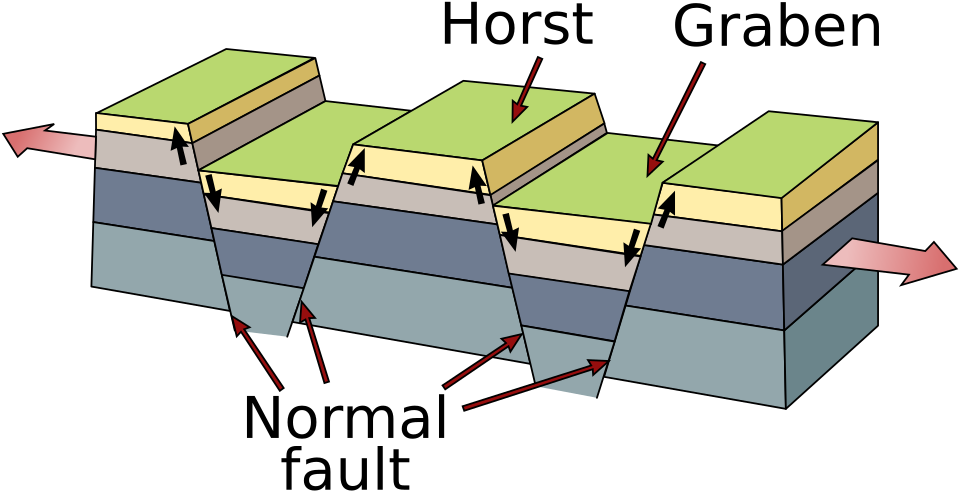
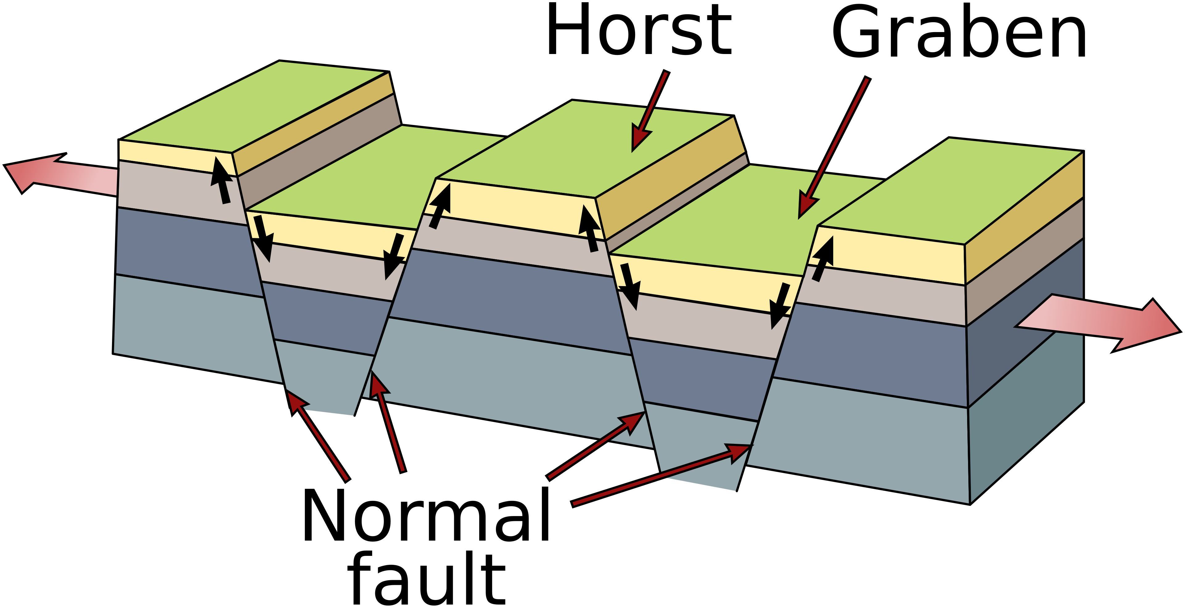
Deutsch: Vereinfachtes Blockdiagramm zur Veranschaulichung eines Horst-und-Graben-Systems in einer Dehnungszone. Die Halbpfeile geben die relative Bewegung an den Verwerfungen an. English: Simplified diagram depicting a horst and graben system in an extensional regime. The half-arrows indicate the relative movement along the fault planes. Español: Estructuras geológicas de horst (pilar tectónico) y graben (fosa tectónica). Galego: Macizo e fasa tectónicos Svenska: Geologisk skiss över horstar och gravsänkor. العربية : البنية الجيولوجية للنتق والأخدود |
||
| Sanasi | (UTC) | ||
| Manba | |||
| Muallif |
|
||
| Other versions |
[]
|



 |
This is a retouched picture, which means that it has been digitally altered from its original version. Modifications: Redraw of pixel (jpg) image as vector (svg). The original can be viewed here: Horst graben.jpg:  . Modifications made by Gregors. . Modifications made by Gregors.
|

|
This image is in the public domain in the United States because it only contains materials that originally came from the United States Geological Survey, an agency of the United States Department of the Interior. For more information, see the official USGS copyright policy.
|
 |
Original upload log
This image is a derivative work of the following images:
- File:Horst_graben.jpg licensed with PD-USGov-USGS
- 2008-12-06T13:29:23Z Woudloper 271x135 (41998 Bytes) {{Information |Description=Schematic cross-section through part of the upper crust under [[:en:extensional tectonics|extensional tectonics]] where [[horst]]s and [[graben]]s formed. |Source= |Date= |Author= |Permission= |othe
- 2005-12-13T17:48:12Z Angrense 346x260 (19398 Bytes) Diagram of a rift formation. Source: {{PD-USGov-Interior-USGS}} from http://earthquake.usgs.gov/image_glossary/horst.html
- 2005-08-25T17:36:54Z Slawojar 346x260 (19398 Bytes) geological structure of [[horst]] and [[graben]] {{PD-USGov-USGS}} [[:en:Image:Horst graben.jpg]] [[Category:Geology]]
Uploaded with derivativeFX
Fayl tarixi
Faylning biror paytdagi holatini koʻrish uchun tegishli sana/vaqtga bosingiz.
| Sana/Vaqt | Miniatura | Oʻlchamlari | Foydalanuvchi | Izoh | |
|---|---|---|---|---|---|
| joriy | 20:40, 2025-yil 14-yanvar | | 534 × 274 (20 KB) | wikimediacommons>Lukask | File uploaded using svgtranslate tool (https://svgtranslate.toolforge.org/). Added translation for pl. |
Fayllarga ishoratlar
Bu faylga quyidagi sahifa bogʻlangan:
