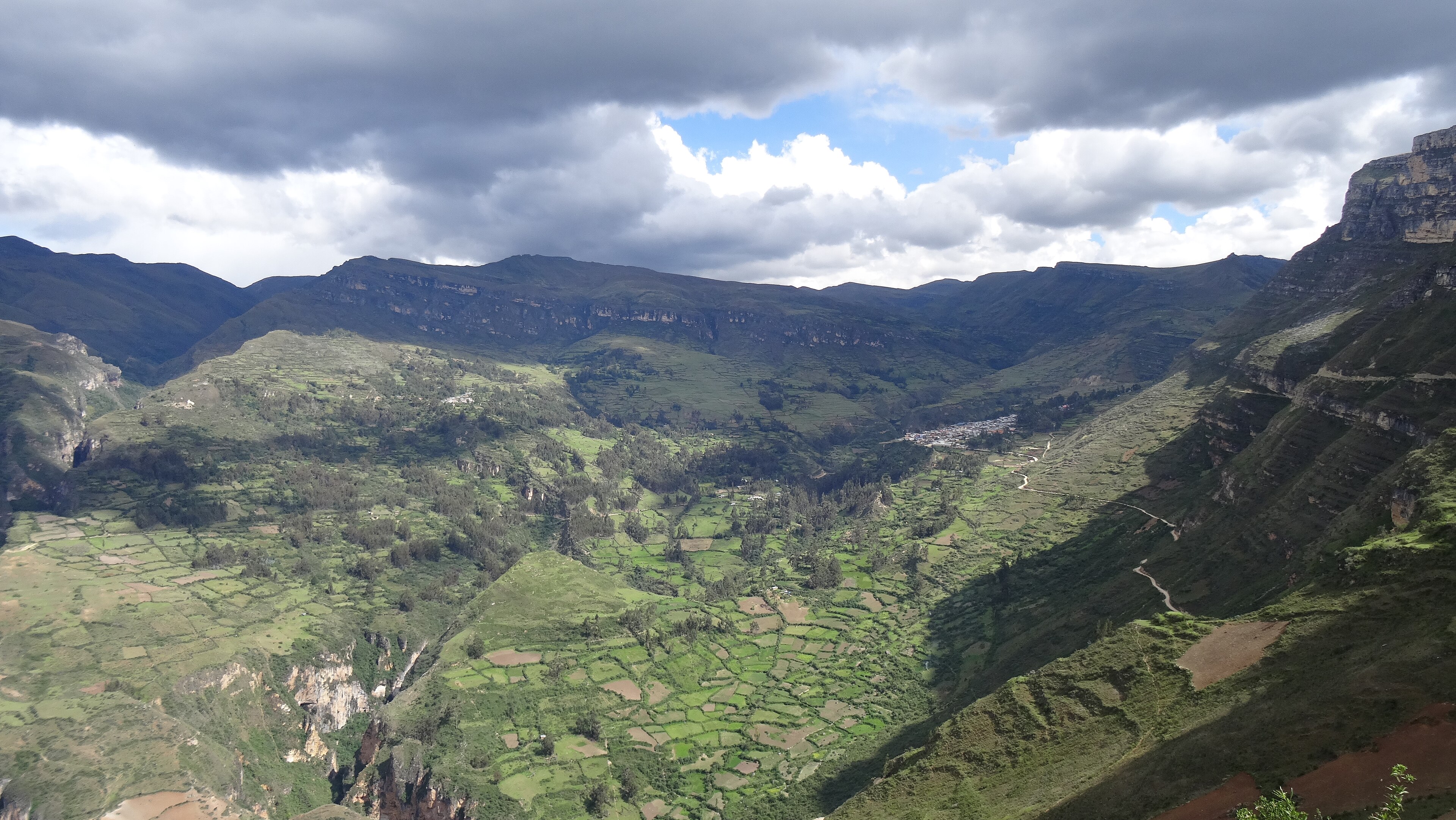
Fayl:Distrito de Huacachi 02971.jpg
Qiyofa
ZiyoSfera, erkin ensiklopediya
Bu prevyuning hajmi: 800 × 451 piksel. Boshqa oʻlchamlari: 2 560 × 1 442 piksel | 5 184 × 2 920 piksel.
Asl fayl (5 184 × 2 920 piksel, fayl hajmi: 5,59 MB, MIME tipi: image/jpeg)
Ushbu fayl Vikiomborga yuklangan boʻlib, boshqa loyihalarda ham qoʻllanilishi mumkin. Uning tavsif sahifasidan olingan maʼlumot quyida keltirilgan.
Qisqa izoh
| TaʼrifDistrito de Huacachi 02971.jpg |
Español: Parte del distrito de Huacachi dividido por la quebrada San Jeronimo, visto desde el norte en el lado noreste del cerro Misión Jirca.
Русский: Часть район Уакачи, разделенная ущельем Сан-Херонимо, которое видно с северо-запада на северо-восточной стороне холма Мисион Хирка. |
| Sanasi | |
| Manba | Oʻzimning ishim |
| Muallif | Waterloo1883 |
| Camera location | 9° 17′ 42,76″ S, 76° 57′ 26,25″ W | View this and other nearby images on: OpenStreetMap |
|---|
Litsenziyalash
I, the copyright holder of this work, hereby publish it under the following license:
This file is licensed under the Creative Commons Attribution-Share Alike 4.0 International license.
- Siz erkinsiz:
- ulashishga – ishlanmani nusxalash, tarqatish va uzatish
- remiks qilishga – ishni moslashtirishga
- Quyidagi shartlar asosida:
- atribut – Siz tegishli litsenziyaga havolani taqdim etishingiz va oʻzgartirishlar kiritilganligini koʻrsatishingiz kerak. Siz buni har qanday oqilona yoʻl bilan qilishingiz mumkin, lekin litsenziar Sizni yoki Sizning foydalanishingizni ma'qullashini taklif qiladigan tarzda emas.
- bir xil ulashish – Agar Siz materialni remiks qilsangiz, oʻzgartirsangiz yoki unga asoslansangiz, oʻz hissalaringizni asl nusxadagi kabi bir xil yoki mos litsenziya ostida tarqatishingiz kerak.
Captions
Add a one-line explanation of what this file represents
Parte del distrito de Huacachi dividido por la quebrada San Jeronimo, visto desde el norte en el lado noreste del cerro Misión Jirca.
Часть район Уакачи, разделенная ущельем Сан-Херонимо, которое видно с северо-запада на северо-восточной стороне холма Мисион Хирка.
Items portrayed in this file
tasvirlangan obyekt
some value
original creation by uploader inglizcha
coordinates of the point of view inglizcha
9°17'42.760"S, 76°57'26.248"W
10 yanvar 2020
captured with inglizcha
Sony DSC-HX50V inglizcha
exposure time inglizcha
0,0015625 soniya
f-number inglizcha
3,5
focal length inglizcha
4,3 millimetr
ISO speed inglizcha
80
image/jpeg
data size inglizcha
5 859 446 Bayt
2 920 piksel
width inglizcha
5 184 piksel
checksum inglizcha
1128ea7ed277f94babaabc0fba66ec34dab2f8ef
Fayl tarixi
Faylning biror paytdagi holatini koʻrish uchun tegishli sana/vaqtga bosingiz.
| Sana/Vaqt | Miniatura | Oʻlchamlari | Foydalanuvchi | Izoh | |
|---|---|---|---|---|---|
| joriy | 01:03, 2020-yil 13-fevral | 5 184 × 2 920 (5,59 MB) | wikimediacommons>Waterloo1883 | User created page with UploadWizard |
Fayllarga ishoratlar
Bu faylga quyidagi sahifa bogʻlangan:
Metama’lumot
Bu fayl qoʻshimcha maʼlumotlarni oʻz ichiga oladi, ehtimol uni tuzish yoxud raqamlashtirish uchun raqamli kamera yoki skanerdan foydalanilgan.
Agar fayl asl holatidan oʻzgartirilgan boʻlsa, baʼzi tafsilotlar oʻzgartirilgan faylni toʻliq aks ettirmasligi mumkin.
| Camera manufacturer | SONY |
|---|---|
| Camera model | DSC-HX50V |
| Exposure time | 1/640 sec (0,0015625) |
| F Number | f/3,5 |
| ISO speed rating | 80 |
| Date and time of data generation | 15:11, 2020-yil 10-yanvar |
| Lens focal length | 4,3 mm |
| Latitude | 9° 17′ 42,76″ S |
| Longitude | 76° 57′ 26,25″ W |
| Altitude | 3 648,9 meters above sea level |
| Orientation | Normal |
| Horizontal resolution | 350 dpi |
| Vertical resolution | 350 dpi |
| Software used | DSC-HX50V v1.00 |
| File change date and time | 15:11, 2020-yil 10-yanvar |
| Y and C positioning | Co-sited |
| Exposure Program | Landscape mode (for landscape photos with the background in focus) |
| Exif version | 2.3 |
| Date and time of digitizing | 15:11, 2020-yil 10-yanvar |
| Meaning of each component |
|
| Image compression mode | 3 |
| APEX brightness | 9,40390625 |
| APEX exposure bias | 0 |
| Maximum land aperture | 3,6171875 APEX (f/3,5) |
| Metering mode | Pattern |
| Light source | Unknown |
| Flash | Flash did not fire, compulsory flash suppression |
| Supported Flashpix version | 1 |
| Color space | sRGB |
| File source | Digital still camera |
| Scene type | A directly photographed image |
| Custom image processing | Normal process |
| Exposure mode | Auto exposure |
| White balance | Auto white balance |
| Digital zoom ratio | 1 |
| Scene capture type | Landscape |
| Contrast | Normal |
| Saturation | Normal |
| Sharpness | Normal |
| GPS time (atomic clock) | 20:11 |
| Receiver status | Measurement in progress |
| Measurement mode | 3-dimensional measurement |
| Measurement precision | Excellent (1,32) |
| Speed unit | Kilometers per hour |
| Speed of GPS receiver | 2,483 |
| Reference for direction of movement | True direction |
| Direction of movement | 240,82 |
| Geodetic survey data used | WGS-84 |
| GPS date | 2020-yil 10-yanvar |
| GPS differential correction | 0 |
| GPS tag version | 0.0.3.2 |