
Fayl:ChlamydotisUndulataIUCN2019 2.png

Bu prevyuning hajmi: 800 × 566 piksel. Boshqa oʻlchamlari: 2 560 × 1 810 piksel | 3 507 × 2 480 piksel.
Asl fayl (3 507 × 2 480 piksel, fayl hajmi: 456 KB, MIME tipi: image/png)
Qisqa izoh
| Taʼrif |
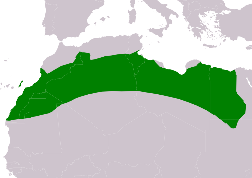
Slovenčina: Mapa rozšírenia druhu drop orientálny (Chlamydotis undulata) podľa IUCN verzia 2019-2 :
legenda: Hniezdiaci, celoročný výskyt (#008000) English: Distribution map of african houbara (Chlamydotis undulata) according to IUCN version 2019-2 ; key: Legend: Extant, resident (#008000) |
| Sanasi | |
| Manba | Made with Natural Earth. Free vetor and raster map data @ naturalearthdata.com. Range map from BirdLife International 2016. Chlamydotis undulata. The IUCN Red List of Threatened Species 2016: e.T22728245A90341807. https://dx.doi.org/10.2305/IUCN.UK.2016-3.RLTS.T22728245A90341807.en. Downloaded on 01 August 2019 as visual indicator of distribution. |
| Muallif | SanoAK: Alexander Kürthy |
Litsenziyalash


Bu fayl Creative Commons asosida litsenziyalangan Attribution- Share Alike 3.0 Unported litsenziyasi.
Attributsiya:
IUCN Red List of Threatened Species, species assessors and the authors of the spatial data.
- Siz erkinsiz:
- ulashishga – ishlanmani nusxalash, tarqatish va uzatish
- remiks qilishga – ishni moslashtirishga
- Quyidagi shartlar asosida:
- atribut – Siz tegishli litsenziyaga havolani taqdim etishingiz va oʻzgartirishlar kiritilganligini koʻrsatishingiz kerak. Siz buni har qanday oqilona yoʻl bilan qilishingiz mumkin, lekin litsenziar Sizni yoki Sizning foydalanishingizni ma'qullashini taklif qiladigan tarzda emas.
- bir xil ulashish – Agar Siz materialni remiks qilsangiz, oʻzgartirsangiz yoki unga asoslansangiz, oʻz hissalaringizni asl nusxadagi kabi bir xil yoki mos litsenziya ostida tarqatishingiz kerak.




Fayl tarixi
Faylning biror paytdagi holatini koʻrish uchun tegishli sana/vaqtga bosingiz.
| Sana/Vaqt | Miniatura | Oʻlchamlari | Foydalanuvchi | Izoh | |
|---|---|---|---|---|---|
| joriy | 18:07, 2019-yil 1-avgust | | 3 507 × 2 480 (456 KB) | wikimediacommons>SanoAK | User created page with UploadWizard |
Fayllarga ishoratlar
Bu faylga quyidagi sahifa bogʻlangan:
