
Fayl:Canada geopolitical map trim.jpg


Qisqa izoh
| Taʼrif |
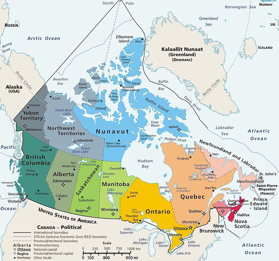
Map of Canada, showing largest cities, lakes and province names. This map has locator code "CanadaGeo" for use in map-locator templates, such as English Wiki Template:Location_map_CanadaGeo & Template:Location_map_polarx (which skews northern coordinates for multiple map markers/labels on a polar map). The latitude/longitude coordinates are not equirectangular, but rather, in polar projection, narrowing at the north, with longitudes about 84% closer together at the top. The use of the narrowing longitudes provides more accurate mapping of area and distance than with rectangular coordinates. The original map image was public domain; the following modifications have been made to the original:
|
| Sanasi | 5-November-2007 (revising map of 10-April-2006) |
| Manba | Derivative of map from User:E Pluribus Anthony geopolitical map (Wikimedia Commons): Image:Geopolitical map of Canada.png (enlarging labels, adding flag & coat-of-arms, magnifying 15%) |
| Muallif | User:E Pluribus Anthony (trimmed by Wikid77, enlarging labels) |
| Other versions |
This map has some variations:
|

Litsenziyalash

|
I, the copyright holder of this work, release this work into the public domain. This applies worldwide. In some countries this may not be legally possible; if so: I grant anyone the right to use this work for any purpose, without any conditions, unless such conditions are required by law. |
Format

This file is purposely maintained in JPEG format for speed compared with the related PNG maps. However, those PNG maps can be used as the "AlternativeMap" parameter when using locator maps. JPEG format is used to condense the details of the coat-of-arms image and coastlines.
Fayl tarixi
Faylning biror paytdagi holatini koʻrish uchun tegishli sana/vaqtga bosingiz.
| Sana/Vaqt | Miniatura | Oʻlchamlari | Foydalanuvchi | Izoh | |
|---|---|---|---|---|---|
| joriy | 09:02, 2012-yil 29-iyun | | 1 182 × 1 107 (200 KB) | wikimediacommons>Wikid77 | cropped to prior edges; +scale in miles |
Fayllarga ishoratlar
Bu faylga quyidagi 2 sahifalar bogʻlangan:
